Firma Esri oznámila, že kupuje firmu nFrames, stojící za vývojem softwaru SURE.
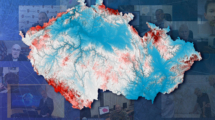
Software SURE se používá pro zpracování obrazových (leteckých, fotogrammetrických) a lidarových dat. Akvizice firmy je v podstatě pokračováním toho, co Esri udělala v roce 2011, kdy koupila firmu Procedural a jejich software CityEngine.
Software SURE bude začleněn do platformy ArcGIS a má uživatelům umožnit bezešvý sběr a analýzu dat z leteckého či pozemního snímkování.
Následuje tisková zpráva v angličtině:
Esri Will Offer World-Class 3D Surface Imaging Technology and Integrate into the ArcGIS Platform
Esri, the global leader in location intelligence, today announced the acquisition of nFrames, a technology company that develops SURETM, an industry-leading imagery and lidar 3D surface reconstruction software. This will enable the fusion of imagery with 3D GIS, allowing nFrames and Esri users to seamlessly capture and analyze 3D data from aerial, drone, and ground-based sensors in an automated end-to-end process.
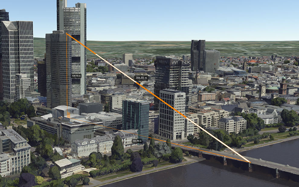
SURE scales 3D data creation to large city and countrywide airborne image datasets and projects, while giving professional photogrammetry workflows improved precision, speed, and simplicity on premises or in the cloud. Through this acquisition, Esri gains a robust production engine that transforms imagery and lidar data into point clouds, phototextured 3D meshes, and true orthos. Users in government; urban planning; or architecture, engineering, and construction (AEC) can use SURE to generate 3D maps at scales from individual construction sites to entire cities and countries—fully automated at higher resolution and repetition rates than ever before.
„nFrames is a leading provider of 3D image reconstruction software and services, and I am excited to welcome the company to the Esri family,“ said Jack Dangermond, Esri founder and president. „As Esri continues down its path of innovation to create a multidimensional experience, this acquisition enhances our ability to create extremely high-quality 3D data from imagery, which is critical for our customers in the municipal, planning, and AEC industries.“
SURE software will become part of the company’s ArcGIS platform. In the future, Esri will make SURE capabilities available in ArcGIS Drone2Map and Site Scan for ArcGIS so users can create better meshes, point clouds, and true orthos from their drone imagery. This will also further improve ArcGIS orthomapping and drone processing capabilities across the platform.
„We are excited to take the next step in our mission of empowering organizations with leading technology for multisensor reality capture—from air and ground,“ said Konrad Wenzel, CEO and cofounder of nFrames. „Together with Esri, we will be able to unlock the full value of 3D surface data through GIS by connecting geometry with metainformation to provide spatial context. This fully automatic chain from data capture to analytics will enable smarter decision-making.“
The nFrames headquarters will now serve as a new Esri R&D center based in Stuttgart, focused on cutting-edge reality capture technology. This R&D center will continue its work on the SURE technology, support SURE customers, and also provide support for 3D GIS across its line of products.
„We are looking forward to working on this vision as part of a global, industry-leading organization, developing cutting-edge solutions with a growing team while serving our customers and partners with the same passion as before,“ continued Wenzel.
For more information about Esri and SURE software, visit go.esri.com/esri-and-nframes.