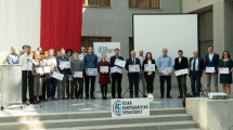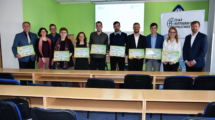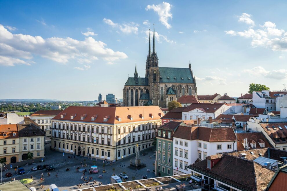
V Brně se koná mezinárodní konference EuroCarto 2026, kterou pořádá Česká kartografická společnost. Zájem byl mimořádný a do Brna přijede více než 260 účastníků, kteří zastupují akademickou sféru, státní a soukromý sektor i nastupující generaci kartografů a geoinformatiků.
Program začíná v úterý 8. září předkonferenčními workshopy, v úterní večer bude akce slavnostně zahájena v aule Právnické fakulty Masarykovy univerzity. Od středy do pátku je naplánován odborný program, přičemž jsou připraveny dva souběžné proudy odborných sekcí, posterová setkání a diskuse věnované celé šíři současné kartografie – od kartografického designu, tematické kartografie a atlasové tvorby přes geovizualizaci, mapovou kognici a kartografické vzdělávání až po GeoAI, strojové učení, digitální dvojčata, webovou kartografii nebo využití velkých prostorových dat.
Součástí programu jsou také čtyři keynotes – vystoupí Kenneth Field, kartograf ve společnosti Esri a jedna z výrazných osobností současného kartografického designu, Ivan Buchta, kreativní vedoucí počítačové hry Arma ve společnosti Bohemia Interactive, Dana Končelíková, psychiatrička působící ve Fakultní nemocnici Olomouc, a Wolfgang Kainz, emeritní profesor kartografie a geoinformační vědy Vídeňské univerzity. Právě prof. Kainz se symbolicky vrací do města, kde se v roce 1987 účastnil konference Euro-Carto VI.
Program nabídne rovněž prostor pro diskusi o nové výzkumné agendě ICA, setkání komisí Mezinárodní kartografické asociace a aktivity zaměřené na mladou generaci kartografů. Ve středu večer se uskuteční setkání Next-Generation Cartographers, zatímco čtvrteční program doplní orientační aktivita. Chybět nebudou ani další neformální příležitosti k setkávání a poznávání Brna.
Workshopy v úterý 8. září
09:00 Workshops
- Share your best tips: Write your own NGC Map Tutorial!
- Facilitator: Jakob Listabarth, Sacha Schlumpf
- Organisation: ICA Working Group Next Generation Cartographers
- Duration: 2 hours
- Room: Z2
- Storytelling with Maps
- Facilitator: Mark Wigley, Alex Kent
- Organisation: Swiss Society of Cartography, British Cartographic Society
- Duration: 2 hours
- Room: Z3
- Hands-On Experiences in Prompt-based Cartography: From Perception to AI Automation
- Facilitator: Izabela Gołębiowska, Arzu Çöltekin, Kenneth Field, Ian Muehlenhaus, Anthony Robinson
- Organisation: ICA Commission on Geovisualization, ICA Commission of Map Design
- Duration: 3 hours
- Room: Z6
- Atlases as Learning Tools in Higher Education: Concepts and Practice
- Facilitator: Mela Žuljević, Eric Losang, Jana Moser, Iaroslav Boretskii
- Organisation: ICA Working Group on Peace and Conflict Cartography, ICA Commission on Atlases
- Duration: 3 hours
- Room: Z4
- Tactile Mapping Workshops
- Time: 9:00, 13:00
- Facilitator: Jakub Wabiński
- Organisation: Military University of Technology in Warsaw, ICA Inclusive Cartography Working Group
- Starts at: 8 September 9:00 (First part), 8 September 13:00 (Second part), 9 September 9:00 (Third part)
- Duration: 2×3 hours, 1×2 hours
- Room: Faculty of Science Library – Right team study room
- Cartographic Education and AI: Exploring New Horizons for Teaching and Learning
- Facilitator: Juliane Cron, Christoph Traun
- Organisation: ICA Commission on Education and Training, UNIGIS International Association
- Duration: 2 hours
- Room: Z5
13:00 Workshops
- Are Large Language Models Advancing Participatory Mapping?
- Facilitator: Jiří Pánek, Lydia Valdesera, Thibaud Chassin
- Organisation: ICA Working Group on Participatory Mapping
- Duration: 3 hours
- Room: Z4
- Mapping the Landscape of Virtual Reality for Education and Crisis Management
- Facilitator: Alžběta Šašinková, Čeněk Šašinka
- Organisation: Masaryk University
- Duration: 2.5 hours
- Room: Z2
- How to Map with Context – A Practitioners’ Workshop
- Facilitator: Ester Scheck
- Organisation: Technische Universität Wien
- Duration: 3 hours
- Room: Z3
- AI for Cartography, Cartography for AI
- Facilitator: Karel Staněk, Izabela Karsznia, Pyry Kettunen
- Organisation: ICA Commission on Multi-Scale Cartography, DGfK Commission on Cartography and AI
- Duration: 3 hours
- Room: Z1
- MentorMatch 2.0: Navigating Careers with Next-Gen Cartographers
- Facilitator: Zulfa Nuraini Afifah, Merve Keskin, Juliane Cron, Anthony Robinson
- Organisation: ICA Working Group Next Generation Cartographers, ICA Commission on User Experience, ICA Commission on Education and Training, ICA Commission on Geovisualization
- Duration: 3 hours
- Room: Z5
- Pre-modern cartography: Preservation, research, and presentation of early maps
- Facilitator: Mela Žuljević, Eric Losang, Jana Moser, Iaroslav Boretskii
- Organisation: ICA Working Group on Peace and Conflict Cartography, ICA Commission on Atlases
- Duration: 3 hours
- Room: Z4
- Navigating Feedback with Nonviolent Communication
- Facilitator: Petr Holík, Tomáš Pavelka
- Organisation: Institute of Nonviolent Communication (INC)
- Duration: 3 hours
- Room: Z6
EuroCarto 2026, středa 9. září
09:00-10:30 Session 1A: Map Use, Cognition & User Studies
CHAIR: Serena Coetzee | LOCATION: Library Hall
- 9:00 David Fairbairn, Georg Gartner and Michael Peterson – Contextualising map use: linking affordances to human agency (PRESENTER: David Fairbairn)
- 9:15 Izabela Gołębiowska, Francis Harvey and Jolanta Korycka-Skorupa – “If I know what I need” – on the importance of subjective metrics in map user studies (PRESENTER: Izabela Gołębiowska)
- 9:30 Marketa Beitlova, Georg Gartner, Tomas Vanicek, Michaela Vojtechovska and Stanislav Popelka – Comparing Paper and Digital Atlas Use (PRESENTER: Marketa Beitlova)
- 9:45 María Caudevilla-Lambán, Timothy J. Prestby, Gareth Baldrica-Franklin, Claudette Kessler, N.T. Nawshin and Robert E. Roth – The Influence of Narrative Structure on Story Map Engagement, Performance, & Trust: A Preliminary Study (PRESENTER: María Caudevilla-Lambán)
- 10:00 Jolanta Korycka-Skorupa – Which map do you prefer and why? A subjective users’ multivariate maps evaluation in the empirical study.
- 10:15 Stanislav Popelka, Marketa Beitlova, Michaela Vojtechovska and Eva Krizova – Understanding USE-IT Map Use through Eye-Tracking (PRESENTER: Stanislav Popelka)
09:00-10:30 Session 1B: GeoAI, Machine Learning & Ethics
CHAIR: Petr Kubicek | LOCATION: F1
- 9:00 Aileen Buckley, Chelsea Nestel and Nat Case – Framing Cartography Codes of Ethics (PRESENTER: Aileen Buckley)
- 9:15 Jochen Schiewe – Preserving Changes After Cartographic Generalization: A Framework and Example of Line Simplification
- 9:30 Ridwan Wahed, Alexander Dunkel and Dirk Burghardt – Large Language Model-Based Classification and Mapping of Personality Traits from Geo-Social Media (PRESENTER: Dirk Burghardt)
- 9:45 Marlon Brass and Florian Hruby – Automatic Schematization of Transit Networks: An Algorithmic Approach (PRESENTER: Florian Hruby)
- 10:00 Natalia Dziuba-Brauner and Stanisław Szombara – Enhancing Automation in Dot Distribution Maps: From Algorithm to User (PRESENTER: Natalia Dziuba-Brauner)
- 10:15 Yuetong Ma – Distilling Institutional Memory: A Human-AI Symbiosis Framework for Cartographic Quality Assurance in UN Peace Operation
10:30-11:00 Coffee Break
11:00-12:30 Session 2A: Atlas Cartography
CHAIR: Izabela Gołębiowska | LOCATION: Library Hall
- 11:00 Eric Losang – The Atlas as Stage – Contemporary Atlas Practices and the Reconfiguration of Spatial Knowledge
- 11:15 Stanislav Krakovskyi – Atlas Explorer: A Research Tool for Atlas Cartography
- 11:30 Oren Raz – The New Digital Atlas of Israel: Transitioning from Print to an Interactive National Cartographic Knowledge Hub
- 11:45 Mela Zuljevic and Iaroslav Boretskii – Visualising Conflict/Peace: Atlas as a format for critical, reflexive and multiperspective (geo)visualisation practices (PRESENTER: Mela Zuljevic)
- 12:00 Vit Vozenilek – Three Czech National Atlases: Will There Ever Be a Fourth?
- 12:15 Daria Hollenstein, Carolin Bronowicz, Christian Gamma and Susanne Bleisch – Improving the Accessibility of the Swiss Cadastral Web Map Service – a Visualization Redesign (PRESENTER: Carolin Bronowicz)
11:00-12:30 Session 2B: Cartographic Design
CHAIR: Amy Griffin | LOCATION: F1
- 11:00 Jakob Listabarth and Sacha Schlumpf – Find your type: Sparking map-makers’ interest in typography (PRESENTER: Jakob Listabarth)
- 11:15 Shangjing Jiang, Yong Wang and Mingguang Wu – Mapping with a Sense of Place: Methods for Generating Place-Specific Map Colors and Symbols (PRESENTER: Shangjing Jiang)
- 11:30 Clarisse Aubert, Andreas Neumann and Lorenz Hurni – Cartographic Arc: The Art of Storytelling in Map Design (PRESENTER: Clarisse Aubert)
- 11:45 Sacha Schlumpf and Georg Gartner – Map Design: What If Less Isn’t More? (PRESENTER: Sacha Schlumpf)
- 12:00 Nina Polous – Maps as Our New Custodian: Navigating Knowledge in Space and Time
- 12:15 Jan Brus, Veronika Ruzickova and Vratislav Machota – Accessible Tactile Cartography and Art through Desktop UV Relief Printing (PRESENTER: Jan Brus)
12:30-14:00 Lunch Break
13:00-14:00 Meeting of the ICA Executive with Chairs of ICA Working Groups and Commissions
13:00-14:00 Sessions 3A · 3B: POSTER SESSION I
LOCATION: Right team study room (Library Atrium)
- Tomas Vanicek and Jakub Zejdlik – MapLogger: A Client-Side Tool for Logging User Interaction in Web Map Usability Studies (PRESENTER: Tomas Vanicek)
- Günter Kyncl and Jakub Lysák – Cartographic Generalization in the Automated Generation of Multiscale Cartographic Representations of Rock Formations (PRESENTER: Günter Kyncl)
- Paraskevi Mikeli and Andriani Skopeliti – Machine Learning-Based Coastline Classification for Semantic Enrichment in Map Generalization (PRESENTER: Andriani Skopeliti)
- Lesly Bautista, Georg Gartner and Sacha Schlumpf – Design and Evaluation of an Interactive Geoportal for Personalized Travel Planning using Map Imitation Techniques (PRESENTER: Lesly Bautista)
- Jakub Šperka, Renata Ďuračiová and Tibor Lieskovský – An Open-Source YOLO & QGIS Workflow for Geospatial Object Detection (PRESENTER: Jakub Šperka)
- Suphaphong Sirinapaphan and Anna Brauer – Privacy, Utility, and Trade-off: A Framework for Evaluating Spatial Aggregation in Mobility Flow Visualization (PRESENTER: Suphaphong Sirinapaphan)
- Daniel Kašík, Tomáš Pavelka, Jan Oprchal, Dajana Snopková, Tomáš Řezník and Lukáš Herman – Automated Extraction and Cartographic Visualisation of Agricultural Machinery Trajectories to Assess Soil Erosion Risks: A Proof-of-Concept Study (PRESENTER: Daniel Kašík)
- Lilly Tockner – Measuring the Impact of AI Adoption on the Sustainability of OpenStreetMap
- Nianhua Liu and Linbing Zhuang – One-Stop and Low-Barrier: A GPT-Powered Crisis Mapping Solution for Emergency Responders (PRESENTER: Nianhua Liu)
- Yi-Ru Liang, Milena Vuckovic, Marlene Huber and Florian Ledermann – Design and Evaluation of a 3D Cartographic Prototype for Visualizing Urban Thermal Stress at City-Block Scale (PRESENTER: Yi-Ru Liang)
- Renata Ďuračiová, Jakub Šperka, Nikita Yakshin and Tomáš Ič – AI-Prompted Workflows for Building Footprint Extraction from LiDAR Data: A Comparative Analysis with Traditional GIS Methods (PRESENTER: Renata Ďuračiová)
- Jan Mikoláš and Lukáš Herman – The Semantic Map Method: Visualizing Spatial Perception (PRESENTER: Jan Mikoláš)
- Alexandra Benová and Dagmar Kusendová – Research on cartographic literacy initiated by Ján Pravda based on map reading – background, approaches, and results (PRESENTER: Alexandra Benová)
- Sofia Fotiadou, Vassilios Krassanakis, Anastasios Kesidis and Giorgos Sfikas – Evolution, Trends, and Challenges of GeoAI in Cartography: A Systematic Review during the period 2000-2024 (PRESENTER: Vassilios Krassanakis)
- Alaattin Arıkan, Turhan Çetin, Emrah Hiğde, Hatice Can and Arzu Çöltekin – Establishing International Normative Values for Spatial Thinking Skills Across World Cultural Regions: A Multilevel Investigation of Individual and Cultural Factors (PRESENTER: Alaattin Arıkan)
14:00-15:30 Session 4A: Geovisualization & Visual Analytics
CHAIR: Anthony Robinson | LOCATION: Library Hall
- 14:00 Christoph Kinkeldey – Communicating Uncertainty in Journalistic Maps: Perspectives from a Data Journalism Research Project
- 14:15 Andrea Miletić and Ana Kuveždić Divjak – Towards a Framework for Measuring User Engagement in Geovisualizations Based on Open Data (PRESENTER: Andrea Miletić)
- 14:30 Zhaoxu Sui and Anthony Robinson – Making vivid maps: expressive geovisualization for representing spatial vulnerability (PRESENTER: Zhaoxu Sui)
- 14:45 Merve Polat Kayali, Ana Basiri and Guy Solomon – Is There Consistency in Visualising Missing Data? A Review of Existing Approaches (PRESENTER: Merve Polat Kayali)
- 15:00 Saana Järvinen, Pyry Kettunen and Anssi Jussila – Visualization and animation trials of 3D geospatial marine oceanographic datasets (PRESENTER: Saana Järvinen)
- 15:15 Maria Fedyszyn and Jakub Koniček – Geovisualization of Mobility Patterns using Multisource Data: A Case Study at Envelopa Campus, Olomouc, Czechia (PRESENTER: Maria Fedyszyn)
14:00-15:30 Session 4B: LIGHTNING TALKS I
CHAIR: Jiri Cajthaml | LOCATION: F1
- 14:00 Iva Cibilic and Vesna Posloncec-Petric – From User Input to Augmented Tourist Map Design: A User-Centred Workflow (PRESENTER: Iva Cibilic)
- 14:05 Tobias Küpper, Sven Gedicke, Jan-Henrik Haunert, Yaghoob Jafari and Annika Bonerath – Detecting Trade Clusters with TradeNetVis: A User Study (PRESENTER: Annika Bonerath)
- 14:10 Radek Barvir and Josef Kubecek – Evaluation of automated orienteering map design possibilities for Czechia (PRESENTER: Radek Barvir)
- 14:15 Sopio Gorgijanidze, Tedo Gorgodze, Teona Tighivili, Gocha Jincharadze, Zaza Gulashvili and Giorgi Dvalashvili – The importance of topographic maps for primary school age groups (PRESENTER: Sopio Gorgijanidze)
- 14:20 Federica Ballardini – Topographic Maps as Risk Interfaces: Visualising Geomorphological Hazards for Outdoor Decision-Making
- 14:25 Apostolos Papakonstantinou, Victor Lion, Arnab Muhuri, Élise Lépy, Thora Herrman and Natascha Oppelt – Enhancing Arctic Resilience through Citizen Science and AI-based Mapping for Marine Pollution Control (PRESENTER: Apostolos Papakonstantinou)
- 14:30 Katarzyna Borczon and Izabela Gołębiowska – How spatial data is used for informed decision making in mountain rescuing? Case study of Polish mountain rescuing organizations (PRESENTER: Katarzyna Borczon)
- 14:35 Nianhua Liu and Ziyu Hu – Rethinking Cartographic Generalization in Mixed Reality for Dynamic Mobility Scenarios (PRESENTER: Nianhua Liu)
- 14:40 Nehir Bera Biçer – Evolution of Soundscape Mapping: Insights from a Bibliometric and Spatio-thematic Analysis (1980-2026)
- 14:45 Filip Dohnal, Radka Lopourová, Michal Kovařík and Václav Talhofer – GIS Applications for Military Logistics Planning: Study from Czechia (PRESENTER: Filip Dohnal)
- 14:50 Saba Modebadze and Demetre Modebadze – Cartographic Visualization in Sports Broadcasting: Spatial Analysis and Geospatial Insights (PRESENTER: Saba Modebadze)
- 14:55 František Mužík, Jiří Krejčí, Vojtěch Cehák, Michal Janovský and Pavel Tobiáš – 3D Reconstruction of the Extinct Vlašim – Dolní Kralovice Railway in Czechia (PRESENTER: František Mužík)
- 15:00 Ermioni Eirini Papadopoulou, Lemonia Moysidou, Georgios Tataris, Nikolaos Soulakellis, Christos Vasilakos, Stavros Proestakis, Thomas Tscheulin and Oliver Schweiger – Real-time in-situ biodiversity recording utilizing UAV mapping and web-application synergy (PRESENTER: Ermioni Eirini Papadopoulou)
- 15:05 Robert Maghlakelidze, Dali Nikolaishvili and Giorgi Maghlakelidze – Some Issues of Mapping Landscape-Geophysical Space-Temporal Characteristics (Geomasses) and Map Analysis (PRESENTER: Robert Maghlakelidze)
15:30-16:00 Coffee Break
15:30-15:40 Group Photo
16:00-17:30 Session 5A: Interactive Map Interfaces
CHAIR: Merve Keskin | LOCATION: Library Hall
- 16:00 Mark Wigley, Karsten Pippig, Tobias Stalder, Sebastian Denier and Christoph Streit – «Base Map» – a new vector tiles-based map for mobile applications (PRESENTER: Mark Wigley)
- 16:15 Wojciech Rymarkiewicz and Beata Medyńska-Gulij – Smartphone holding styles and easy-to-reach zones on mobile map apps (PRESENTER: Wojciech Rymarkiewicz)
- 16:30 Michaela Vojtechovska and Stanislav Popelka – GazeDeck: Multi-Glasses Gaze Interactions on Arbitrary Cartographic Surfaces (PRESENTER: Michaela Vojtechovska)
- 16:45 Johannes Müller – Inconsistent panning and zooming in globe views across leading geospatial services
- 17:00 Markus Jobst, Florian Twaroch, Andreas Pammer and Georg Gartner – Geospatial Knowledge Organisation of a National Map in AI Driven Ecosystems (PRESENTER: Markus Jobst)
- 17:15 Radek Barvir, Rostislav Netek and Jakub Hermann – Did You Miss Anything in Your Map? Introducing MapCheck: A Checklist-Based Evaluation Tool (PRESENTER: Radek Barvir)
16:00-17:30 Session 5B: Spatial Cognition & Navigation
CHAIR: Beata Medyńska-Gulij | LOCATION: F1
- 16:00 Denise O’Meara, Julian Keil, Dennis Edler and Frank Dickmann – Take Me Home: How Locomotion Methods in Virtual Reality Affect Path Integration Performance (PRESENTER: Denise O’Meara)
- 16:15 Paweł Cybulski, Jakub Zawadzki, Wojciech Rymarkiewicz and Krzysztof Zagata – Self-Orientation, Eye Movements, and Wayfinding Efficiency in an Orienteering Simulator (PRESENTER: Paweł Cybulski)
- 16:30 Annika Korte, Julian Keil and Frank Dickmann – Relationship between different spatial ability questionnaires, spatial orientation, and mental rotation (PRESENTER: Annika Korte)
- 16:45 Tomas Vanicek and Stanislav Popelka – Usability Evaluation of Interactive Cartographic Visualisations by means of Eye-tracking (PRESENTER: Tomas Vanicek)
- 17:00 Dušan Petrovič, Ivana Gobec and Ida Meyer – Towards Standardization for Mapping Indoor Environment (PRESENTER: Dušan Petrovič)
- 17:15 Barbora Jančová and Stanislav Popelka – User testing of reading maps with a dark background (PRESENTER: Stanislav Popelka)
17:30-18:00 Session 6: New ICA Research Agenda – Panel Discussion
Georg Gartner & Haosheng Huang | LOCATION: Library Hall
EuroCarto 2026, čtvrtek 10. září
09:00-10:30 Session 7A: Thematic Mapping
CHAIR: Jana Moser | LOCATION: Library Hall
- 9:00 Ayako Kagawa – Mapping uncertainties in the United Nations peace operations
- 9:15 Lucie Marková, Tomáš Glomb, Sebastian Kheml and Ondřej Homolka – Mapping medical infrastructure, mines, and veterans as potential predictors of the worship of Asclepius in Roman Dacia (PRESENTER: Lucie Marková)
- 9:30 Serena Coetzee, Ton Markus and Britta Ricker – Where are the small islands? Raising their visibility through vignettes on global maps (PRESENTER: Serena Coetzee)
- 9:45 Emily Meriam – Blending with Intent: Color Design for Bivariate Thematic Maps
- 10:00 Paula Berenike Mennerich and Christoph Kinkeldey – Beyond Winner-Takes-All: Evaluating Grid Cartograms for a More Differentiated Representation of German Election Results (PRESENTER: Paula Berenike Mennerich)
- 10:15 Jan Koudelka – Selection of a Suitable Cartographic Projection for the State Area
09:00-10:30 Session 7B: GeoAI & Data-driven Cartography
CHAIR: Otakar Čerba | LOCATION: F1
- 9:00 Marta Solarz and Izabela Gołębiowska – From 75 Million Images to a Verified Dataset of Statistical Maps: A Multi-Stage Extraction Pipeline Combining Active Learning and Vision Language Models (PRESENTER: Marta Solarz)
- 9:15 Albert Adolf, Izabela Karsznia, Robert Weibel, Cheng Fu and Zhiyong Zhou – Advancing Graph Convolutional Networks to Improve Road Network Selection for Small-Scale Maps (PRESENTER: Albert Adolf)
- 9:30 Yong Wang, Shangjing Jiang, Weixiang Zhou and Jiping Liu – Research on Natural-Language-Triggered Automatic Generation of Disaster Maps (PRESENTER: Yong Wang)
- 9:45 Kacper Sobczak and Izabela Gołębiowska – Information Distortion and Cartographic Quality in AI-Generated Thematic Maps (PRESENTER: Kacper Sobczak)
- 10:00 Rafael Osvald, Hana Bobáľová, Vladimír Falťan and Alexandra Benová – Automated Mapping of Urban Green Spaces Using Object-Based Image Analysis with Application to European Cities (PRESENTER: Rafael Osvald)
- 10:15 David Šklíba and Tomáš Bayer – Automated Settlement Label Placement with Contrast and Clutter Optimization (PRESENTER: David Šklíba)
10:30-11:00 Coffee Break
11:00-12:30 Session 8A: Cartography & Education
CHAIR: Vit Vozenilek | LOCATION: Library Hall
- 11:00 Serena Coetzee, Nerhene Davis, Gertrud Schaab, Faith Karanja, Christiaan Struwig and Hlamarisa Ndlovu – Exploring a blended learning approach with maps for developing sense of place (PRESENTER: Serena Coetzee)
- 11:15 Lenka Krajňáková, Martin Hanus, Tomáš Bendl, Oldřich Mokruša and Miroslav Marada – From first encounters to expertise? Pupils’ understanding of contour lines across educational levels (PRESENTER: Lenka Krajňáková)
- 11:30 Xiyu Wang – From Daily Life to the Future: Cultivating Spatial Literacy and Sustainability Awareness through the World Children’s Map Competition
- 11:45 Stephan Wondrak – Cartography versus Geomatics Education in Switzerland
- 12:00 Petra Krsková, Jakub Lysák and Benjamin David Hennig – Metrics for evaluating mosaic cartograms (PRESENTER: Petra Krsková)
- 12:15 Pyry Kettunen, Anna Saarinen and Saana Järvinen – Towards cartographic xR representation – case topobathymetric hypsometric colouring (PRESENTER: Pyry Kettunen)
11:00-12:30 Session 8B: Atlas Cartography II
CHAIR: Jochen Schiewe | LOCATION: F1
- 11:00 Luca Gaia, Andreas Neumann and Lorenz Hurni – Atlas of Switzerland Web: Genesis of a Web Atlas (PRESENTER: Luca Gaia)
- 11:15 František Mužík and Jiří Cajthaml – Enhancing a Printed Vltava River Atlas with Augmented Reality (PRESENTER: František Mužík)
- 11:30 Marcin Wereszczyński and Izabela Gołębiowska – Who does it belong to? How atlas maps show border changes (PRESENTER: Marcin Wereszczyński)
- 11:45 Irene Sahagún Luís – New printed edition of the National Atlas of Spain: Part VI. Social services and facilities
- 12:00 Christian Wohlert, Andreas Neumann and Lorenz Hurni – Dynamic Contextualization: Redefining User-Driven Base Map Interaction within the Atlas of Switzerland Web (PRESENTER: Christian Wohlert)
- 12:15 Bamidele Oke, Keskin Merve, Alena Vondráková and Vit Vozenilek – Tactile Atlas of Nigeria: Development of educational cartographic materials about Nigeria for students with visual impairments (PRESENTER: Bamidele Oke)
12:30-14:00 Lunch Break
13:00-14:00 Sessions 9A: POSTER SESSION II
LOCATION: Right team study room (Library Atrium)
- Guliza Liparteliani, Roman Kumladze, Manana Kurtubadze, Nato Sologhashvili, Sophio Khorbaladze, Gvantsa Tsirgvava, Anna Sherozia and Salome Nikoleishvili – Development of a Regional Atlas Series and Interactive Web Atlas in Georgia (PRESENTER: Roman Kumladze)
- Šárka Mindova, Adam Rusinko, Vladimír Šagát and Vladimír Falťan – Interpreting Vineyard Landscape Heritage Through Historical Military Maps and LiDAR Data: The Little Carpathians Case Study (Slovakia) (PRESENTER: Šárka Mindova)
- Marco Lutz, Emilie Lüdicke, Daniel Heßdörfer, Tobias Ullmann and Melanie Brandmeier – Ensemble Machine Learning and Derivative Spectroscopy for Robust Estimation of Plant Physiological Traits in Precision Viticulture (PRESENTER: Marco Lutz)
- Alikhan Beisenbayev and Georg Gartner – Scrolling Through the Heat: Evaluating User Engagement in an Interactive Map-Based Narrative of Urban Heat Across European Cities (PRESENTER: Alikhan Beisenbayev)
- Mario Stöger – Cartographic Representation of African History: Ethiopia and Eritrea, 1875-1914
- Petra Justova and Jitka Mocickova – Cartographic Image vs. Reality: Spatial Overlay Analysis of Maps Depicting the Czech-German Ethnic Border (1840s-1930s) (PRESENTER: Petra Justova)
- Hana Bobáľová and Filip Škorvaga – Heat vulnerability index mapping across spatial scales: effects of data sources and resolution in urban environments (PRESENTER: Hana Bobáľová)
- Nikita Yakshin – Assessment of Water Presence in River Channels Using Airborne LiDAR Data
- Oldřich Mokruša and Lenka Krajňáková – From 2D to 3D: Teachers’ perspectives on 3D printed models in geography education (PRESENTER: Oldřich Mokruša)
- Anna Auermüllerová, Zdeněk Stachoň, Eliška Kolarczyková, Čeněk Najser, David Večeřa and Petr Vrána – Mapping Sustainable Development Goals at the Regional Scale: A Student Perspective (PRESENTER: Anna Auermüllerová)
- Gabriela Godiskova, Zdeněk Stachoň, Viktória Olívia Haštová, Hugo Krotil, Marek Ladňák and Eva Chodějovská – Communication Networks: From Early Modern Moravia to Contemporary Czech Republic (PRESENTER: Gabriela Godiskova)
- Maria Caudevilla-Lambán, Raúl Postigo-Vidal and María Zúñiga-Antón – Mapping tourism potential: a GIS based analytical model applied to Aragón, Spain (PRESENTER: Maria Caudevilla-Lambán)
- Jakub Miřijovský, Karel Macků and Stanislav Popelka – When a Historical Map Comes Back to Life: The Janovice Estate (1759) in a Digital Environment (PRESENTER: Stanislav Popelka)
13:00-14:30 Sessions 9B · 9C: ICA commission on Early Warning & Crisis Management · ICA commission business meetings
14:00-15:30 Session 10A: 3D Geovisualization
CHAIR: Susanne Bleisch | LOCATION: Library Hall
- 14:00 Ermioni Eirini Papadopoulou, Lemonia Moysidou, Stavros Proestakis, Nikolaos Soulakellis, Ioannis Chorianopoulos and Electra Petracou – Digital twins for understanding territorial dynamics: A case study of the Moria Camp, Lesvos, Greece (PRESENTER: Ermioni Eirini Papadopoulou)
- 14:15 Beata Medyńska-Gulij – Topographic databases in the creation of immersive geovisualizations for natural heritage sites
- 14:30 Katrin Reichert, Julian Keil, Dennis Edler and Frank Dickmann – Indications of (not so clear) Gender Differences in VR-based Urban Fear Spaces (PRESENTER: Katrin Reichert)
- 14:45 Krzysztof Pokonieczny – Concept of a Geospatial Digital Twin for Crisis Management and Military Applications: Information Scope and Data Modelling
- 15:00 Apostolos Papakonstantinou and Pavlos Demetriades – Beyond 3D Models: Leveraging multiscale 3D Geovisualization and GeoBIM for Next-Generation PropTech Applications (PRESENTER: Apostolos Papakonstantinou)
- 15:15 Róbert Fencík – Automated 3D Modelling of LoD2 Buildings Based on Data of Aerial Laser Scanning
14:00-15:30 Session 10B: LIGHTNING TALKS II
CHAIR: Pyry Kettunen | LOCATION: F1
- 14:00 Kostas Gružas – Are We Truly Exploiting the Potential of Geospatial Data? The Case of Territorial Differentiation in Lithuania
- 14:05 Einat Alon – Statistical Atlas on the Gender Equality Index
- 14:10 Martin Knura – Map Generalization using Deep Learning and Constraints: Best of both worlds?
- 14:15 Vojtěch Müller and Tomáš Bayer – Automated detection of terrain depressions in spatial data using a contour tree-based approach (PRESENTER: Vojtěch Müller)
- 14:20 Hongmei Yin and Qifei Mao – An inconsistency detection and processing method for patch boundary under multiple constraints (PRESENTER: Hongmei Yin)
- 14:25 Anna Karapetyan, Vahagn Muradyan and Narek Kroyan – Features of the Armenian National Spatial Data Infrastructure Development (PRESENTER: Narek Kroyan)
- 14:30 Thibaud Chassin, Simon Herz, Shaily Gandhi and Merve Keskin – Early Lessons from Adapting the Colouring Cities Framework for Graz, Austria (PRESENTER: Thibaud Chassin)
- 14:35 Marek Wyszyński – Dynamic Cartography of Terrain Mobility: A GeoAI and Web Mapping Approach to Passability Assessment
- 14:40 Xiaolong Wang and Georg Gartner – Automating construction of cartographic ontology for transparent map-making decisions (PRESENTER: Xiaolong Wang)
- 14:45 Zurab Laoshvili, Giorgi Khachidze, Tamari Gordesiani and Sergo Kvizhinadze – Geographical Information System of Landscapes of Georgia (PRESENTER: Zurab Laoshvili)
- 14:50 Dennis Dvorak and Tomas Bayer – Deterministic Edge Extraction and Generalization for 3D Cartography (PRESENTER: Dennis Dvorak)
- 14:55 Yao Cheng and Wenjuan Lu – Geographic entity matching based on spatial and semantic features (PRESENTER: Yao Cheng)
- 15:00 Revaz Tolordava, Tedo Gorgodze and Gocha Gudzuadze – Geographical and Cartometric Analysis of the State Border in a High-Mountain Region (from a case study of the Georgian-Russian state border – the Abkhazian section of the Caucasus) (PRESENTER: Revaz Tolordava)
- 15:05 Wenjuan Lu and Yao Cheng – Typical Road Network Spatial Structure Recognition and Intelligent Selection Scheme Recommendation Coupling Semantic-Spatial Features (PRESENTER: Wenjuan Lu)
15:30-16:00 Coffee Break
16:00-17:30 Session 11A: Mobility Visualization
CHAIR: Oren Raz | LOCATION: Library Hall
- 16:00 Amy Griffin, Chloe Begg, Paula Dootson, Erica Kuligowski, Angela Gardner and Gita Pupedis – Do bushfire spread prediction maps encourage people to take appropriate protective actions? (PRESENTER: Amy Griffin)
- 16:15 Matej Blazsek, Monika Kopecká, Šimon Opravil and Daniel Szatmári – Assessing agricultural landscape diversity between 2022 and 2023 using rectangular and hexagonal grid frameworks (PRESENTER: Matej Blazsek)
- 16:30 Ana Kuveždić Divjak, Ana Batur and Andrea Miletić – Visualizing Animal Movement in Static Maps: A Case Study of White Stork Migration (PRESENTER: Ana Kuveždić Divjak)
- 16:45 Zulfa Nuraini Afifah and Jukka M Krisp – Designing Uncertainty Visualization for Noise Map (PRESENTER: Zulfa Nuraini Afifah)
- 17:00 Josef Münzberger and Eva Chodějovská – Mapping Early Modern Mobility: From Fragmentary Sources to Spatial Patterns (PRESENTER: Josef Münzberger)
- 17:15 Lourens Snyman, Christo Venter and Serena Coetzee – Visualizing minibus taxi availability in the City of Tshwane Metropolitan Municipality (PRESENTER: Serena Coetzee)
16:00-17:30 Session 11B: Participatory & Inclusive Mapping
CHAIR: Dusan Petrovic | LOCATION: F1
- 16:00 Nat Slaughter – The Arctic, a Personal Project or: Lessons and Observations When Working with Content that Continuously Evolves
- 16:15 Jiri Panek and Diana Ritterová – Cartographic Implications of Geometry Choice in Participatory Mapping: A Comparative Study of Two-Wheeled Urban Mobility in Olomouc and Reykjavík (PRESENTER: Jiri Panek)
- 16:30 Andriani Skopeliti, Margarita Kokla and Dimitra Zacharopoulou – City center tactile map produced by 3d printing (PRESENTER: Dimitra Zacharopoulou)
- 16:45 Jakub Konicek, Jiri Panek, Jakub Zejdlik and Tomas Polak – Cartographic aspects of processing, visualization and publication of emotional mapping data (PRESENTER: Jakub Konicek)
- 17:00 Saba Modebadze, Alexander Wolodtschenko, Demetre Modebadze and Lika Tsertsivadze – Meta-Photoatlases as Semiotic Knowledge Models: From Atlasgraphy to Atlas Semiotics (PRESENTER: Saba Modebadze)
- 17:15 Jan Brus, Eric Mijts, Carolyn Fish and Britta Ricker – From Observation to Participation: Redefining Cartography for Sustainable Development Through a Small Island Workshop (PRESENTER: Jan Brus)
17:30-18:00 Session 12A: Keynote – Ivan Buchta
CHAIR: Stanislav Popelka | LOCATION: Library Hall
17:30-18:00 Session 12B: Keynote – Dana Končelíková
CHAIR: Zdeněk Stachoň | LOCATION: F1
19:00-23:00 Gala Dinner
Garden of the Augustinian Abbey (Augustiniánské opatství), Mendel Square 1a (Mendlovo Náměstí)
EuroCarto 2026, pátek 11. září
08:30-09:00 Session 13A: Keynote – Kenneth Field
CHAIR: David Fairbairn | LOCATION: Library Hall
08:30-09:00 Session 13B: Keynote – Wolfgang Kainz
CHAIR: Milan Konecny | LOCATION: F1
09:00-10:30 Session 14A: Web Cartography
CHAIR: Róbert Fencík | LOCATION: Library Hall
- 9:00 Ian Muehlenhaus – Prompt cartography (or: How I learned a map is only worth 1000 words)
- 9:15 Petra Ďuračiová and Nicolas Bozon – Next-Generation Vector Tiles Cartography (PRESENTER: Petra Ďuračiová)
- 9:30 Jakob Listabarth and Dirk Burghardt – Redraw the map: a web application for polygon schematization (PRESENTER: Jakob Listabarth)
- 9:45 Jakub Zejdlik and Vit Vozenilek – 3D-Geo-Vis: A Geovisualization Tool for Visual Analysis of Thematic Data in 3D (PRESENTER: Jakub Zejdlik)
- 10:00 Adi Singhania, Atima Tharatipyakul, Nihal Z. Miaji and Michael Gastner – Does Your Mapped Variable Add Up? Statistical Guardrails for Web-Based Cartogram Generation (PRESENTER: Michael Gastner)
- 10:15 Otakar Čerba – Maps of European Biodiversity Typology
09:00-10:30 Session 14B: Applied Cartography
CHAIR: Daniel Szatmári | LOCATION: F1
- 9:00 Augustas Reikertas and Neringa Mačiulevičiūtė-Turlienė – Multicriteria Assessment of Cemeteries as Urban Green Spaces: The Case of Vilnius City Municipality (PRESENTER: Augustas Reikertas)
- 9:15 Wojciech Dawid – Geometric comparison of open Microsoft Building Footprints and official data – a case study from Poland.
- 9:30 Annabelle Kiefer, Jakub Koniček and Christoph Traun – Urban Heat Islands in Olomouc: A Geospatial Identification of Thermal Patterns, Urban Structure, and Human Perception (PRESENTER: Jakub Koniček)
- 9:45 Artak Piloyan and Sarhat Petrosyan – Rethinking urban green space accessibility through a GIS-based perspective in Yerevan, Armenia (PRESENTER: Artak Piloyan)
- 10:00 Krisztián Kerkovits – Approximation of the best conformal map projection for the territory of Hungary
- 10:15 Daniel Vrbík and Václav Lábus – A Framework for Reconstructing Street Name and Geometry Changes Over Time: The Case of Liberec (PRESENTER: Daniel Vrbík)
10:30-11:00 Coffee Break
11:00-12:30 Session 15A: Cartographic Heritage
CHAIR: Dirk Burghardt | LOCATION: Library Hall
- 11:00 Lorenz Hurni – 170 years of Cartography at ETH Zurich: the Contributions to Relief Cartography
- 11:15 Tome Marelić – How Portolan Charts Could Have Been Assembled Utilising Cartographic Sources from Classical Antiquity
- 11:30 Kai Helge Wirth and Manfred F. Buchroithner – Heaven and Earth – How Early Cartographers Inscribed Terrestrial Routes into the Sky (PRESENTER: Kai Helge Wirth)
- 11:45 Tedo Gorgodze, Gocha Gudzuadze, Nodar Khorbaladze and Vakhtang Tkeshelashvili – Creation and Use of Topographic Maps in Georgia – History and Modernity (PRESENTER: Tedo Gorgodze)
- 12:00 Jakub Zawadzki and Beata Medyńska-Gulij – Topographic Cues in Cultural Heritage Exploration: A User-Based Map Study in the Poznań Fortress Area (PRESENTER: Jakub Zawadzki)
- 12:15 Julijan Sutlović – Visual semiotics of nautical charts of the Adriatic Sea (13th-19th centuries): encoding power, identity and territory
11:00-12:30 Session 15B: Applied Cartography II
CHAIR: Eric Losang | LOCATION: F1
- 11:00 Ester Scheck – The data context gap in cartography textbooks and handbooks
- 11:15 Nicolás Martínez Heredia, Georg Reinhardt and Marianna Sonneck – Mapping for inter-species democracy: a perspectivist map of ecological relations (PRESENTER: Nicolás Martínez Heredia)
- 11:30 Evlalia Karagianni and Andriani Skopeliti – What Do Experts Trust in Maps? (PRESENTER: Evlalia Karagianni)
- 11:45 Weichen Xu and Nianhua Liu – How Individual Differences Influence Indoor Emergency Escape Training under 2D Mini-maps and X-ray Visualizations: A Webcam User Study (PRESENTER: Nianhua Liu)
- 12:00 Emmanuel Stefanakis – Neural-Based Cartographic Relief Shading for Alberta
- 12:15 Tengiz Gordeziani – The concept of spatio-temporal cartography: system, connections, functions
12:30 Closing Ceremony
LOCATION: Library Hall
/ text ze zpravodaje ČKS, redakčně upraven